Description
Professional 3D LiDAR Site Scan
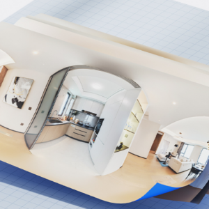
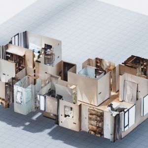
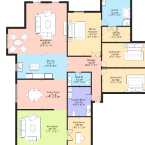
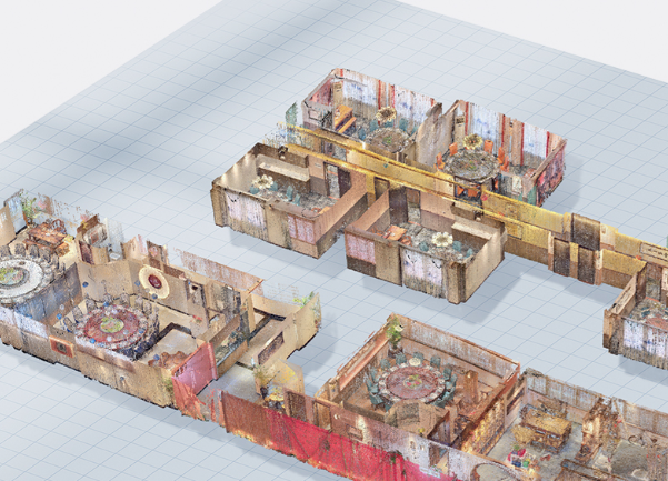
This is the foundation of your digital twin. Our service begins with a comprehensive on-site inspection to determine the optimal scanning path, ensuring every architectural detail is captured without “blind spots.” Using the Realsee Galois system, our team will meticulously scan the building, utilizing high-density laser pulses to map the geometry of your space in real-time.
Beyond just a simple walkthrough, this process captures millimeter-accurate spatial data and 134MP panoramic imagery simultaneously. We handle all the technical heavy lifting—from managing lighting conditions to ensuring structural alignment—so you receive a perfectly stitched, high-resolution 3D model that serves as a permanent, accessible record of the physical environment.